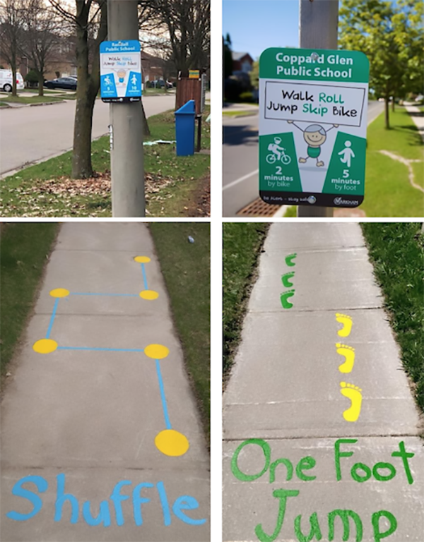
School communities across the province are running wayfinding projects. Wayfinding signs build community awareness and help students and parents plan their active journey to school by giving information about active travel distances to school.
Pictured above are wayfinding and pavement stencils in Markham. The York Region District School Board’s Active School Travel project looked at a cluster of the student population and the neighbourhood walking network. Wayfinding signs were placed at 5, 10, and 15 minute walking points. Stencils were drawn within approximately 400m from the school, 6-8 ft. in length and roughly 50m-150m apart. Locations were chosen based on neighbourhood walkability, typically long lawn spacing, parks or near fences.
Are you considering wayfinding in your community?
Check out these wayfinding resources:
- City of London’s Active and Safe Routes to School project
- Waterloo Region’s Active and Safe Routes to School project Signing Routes to School: A Process Evaluation
- Thunder Bay’s EcoSuperior Environmental Programs WoW TBay program coordinator Caroline Cox’s recent article “Walk to school! It’s closer than you think.” as published in August issue of The Walleye.

